


The Best Photogrammetry Software For All Levels
When it comes to 3D printing, one of the most critical steps is obviously having a 3D model to print. There are a number of different ways these can be obtained including CAD and other modeling software and scanners, but one that has been increasing in popularity in recent years is photogrammetry. Similar to 3D scanning, photogrammetry software allows users to obtain reliable data from real-world objects in their natural state by recording, measuring, and interpreting in this case photographic images. It is often used by surveyors, architects, and engineers to create topographic maps, meshes, points of clouds, or drawings based on the real world. In 3D printing, it is especially useful for capturing large objects and is considered to be more accessible and affordable than 3D scanning as it can be even done with a smartphone camera. In the following ranking (organized in no particular order), we will introduce some of the most well-known photogrammetry software currently available!
ReCap Pro by Autodesk
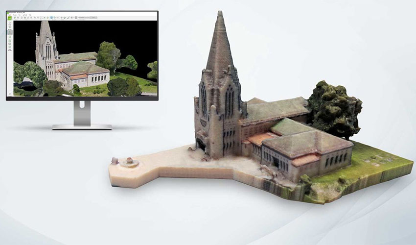
Developed by the well-known software company Autodesk, ReCap Pro is a program capable of converting photographs into 3D models or 2D drawings. With a name derived from the abbreviation of “Reality Capture”, the software has been designed to meet the needs of all types of projects in surveying, planning, as well as the construction, and renovation of buildings and infrastructures. On the technical side, it allows you to easily generate a point cloud or mesh ready to be used with other software or CAD tools. Worth noting is the fact that the new 2023 ReCap Pro version includes a number of improvements and updates for users. Among them, users can find the import and indexing of raw scans, automatic terrain classification for infrastructure projects, or an improvement in rendering quality by increasing the number of points depending on the user’s memory, among others. As for the price of the software, Autodesk several paid subscription options.
3DF Zephyr
3DF Zephyr is a software solution by 3DFlow, it deals with the automatic 3D reconstruction of an object no matter what sensor, drone, or laser scanner device you are using. In other words, with this professional photogrammetry software, while it generates 3D scans with ease, experienced users can make extensive alterations to optimize the result. A user can also export the model into many file formats. Moreover, you can combine photogrammetry data with laser scans for more precision in your model, and working with your model in another CAD program is facilitated thanks to 3DF Zephyr. A free version exists, however you are limited to 50 images for a 3D reconstruction. Though there are also a number of paid versions with different features.
RealityCapture
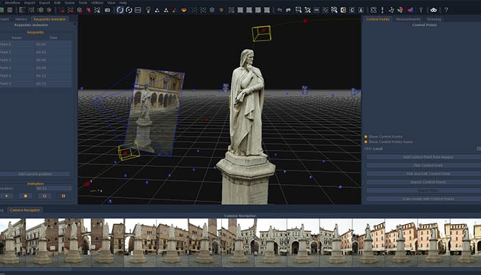
CapturingReality created the RealityCapture photogrammetry software that works with a wide variety of input media. RealityCapture enables you to create virtual reality scenes, textured 3D meshes, orthographic projections, geo-referenced maps, and much more from images. It is also possible to work with laser scans on this software if you are looking for both options. The user interface is clean and modern, as well as intuitive for people who haven’t used this software before. The company offers four different plans for its software, ranging from a plan for casual usuals all the way up to one for bigger business projects.
ContextCapture
Bentley’s ContextCapture photogrammetry software allows users to produce 3D models from ordinary photographs for any infrastructure project. For more precision, the addition of points resulting from laser scans allows obtaining fine details, sharp edges, and geometrical precision. The software can quickly create and use highly detailed 3D reality meshes to provide real and accurate context for design, construction, and operational decisions throughout the project. ContextCapture can also reliably and quickly produce 3D models at any scale, from objects with measures ranging from a few centimeters to entire cities. The accuracy of the resulting 3D model is limited only by the resolution of the image that the user applies. Finally, Bentley’s software avoids spending unnecessary resources on additional equipment and training. Users can simply grab their smartphone camera to capture images and then model a project.
Agisoft Metashape
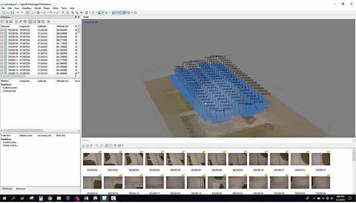
Agisoft Metashape is professional photogrammetry software that processes digital images for various applications, such as Geographic Information System applications, cultural heritage documentation, visual effects, and production, as well as for indirect measurements of objects of various scales. Some important features enable Metashape to process various types of imagery (whether aerial or close-range), output a point cloud, measure distances, areas and volumes, and generate 3D meshes that can then be exported to various popular formats. It is also possible to edit 4D models, which means entire scenes can be recorded in 3D and then edited on the software. Two editions of Agisoft Metashape licenses exist, a professional one and a standard option, with very different price points.
AliceVision Meshroom
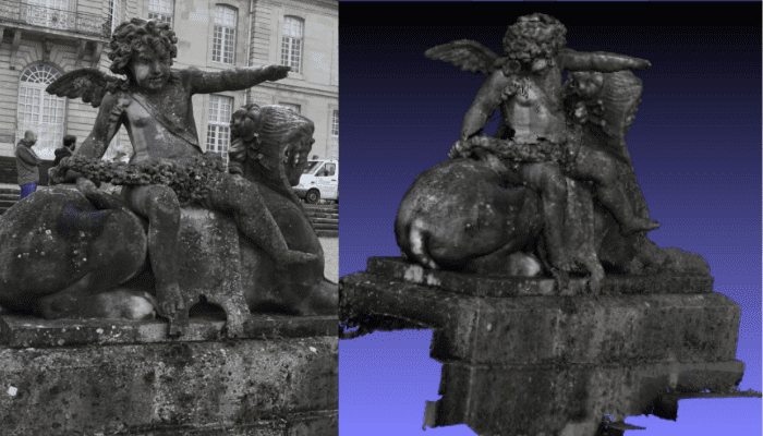
Meshroom by AliceVision is a free and open-source 3D reconstruction software that uses photographs to create the textured mesh that will become the structural build of your 3D model. AliceVision is a photogrammetric computer vision framework that relies on a community of people that invest in the creation of open-source software such as Meshroom. You can learn more about this open-source solution in the video below.
Colmap
Colmap is a versatile Structure-from-Motion (SfM) and Multi-View Stereo (MVS) software with a graphical and command line interface. It offers a wide range of features for the reconstruction of ordered and unordered image collections. The software runs under the new BSD license. Colmap is based on existing works and when a user applies specific algorithms to the software, he or she must also cite the original authors.
DroneDeploy
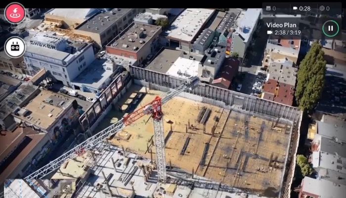
DroneDeploy is a solution for building aerial maps and models from images captured with DJI drones. The software that was designed by the San Francisco-based company allows operators to create aerial maps and 3D models quickly. The easy-to-use mapping software is suitable for beginners and advanced users and features a variety of autonomous flight features, which can be applied by using the DroneDeploy mobile app. In addition to that, the software has a number of useful functions such as different types of in-field data analysis and the ability to generate precise 2D maps, 3D models, and even 360 panoramas, which can easily be shared with an entire team or with customers, and much more. DroneDeploy offers many different pricing models for Individual use or for teams. A free, one-month trial version is available as well.
Pixpro
Pixpro, developed by Pixpro UAB, is a photogrammetry software that can create maps and 3D models using photos from any drone or camera. Suitable for professionals and beginners, it is easy to use and master thanks to a simple user interface and a familiar layer-based system. The comprehensive software offers cloud processing, providing identical results on any Windows PC or laptop hardware. Pixpro’s main features include instant 2D and 3D measurements, optimized ground control point (or GCP) workflows, which allow accurate mapping of large areas, and the export of all generated or drawn layers. In addition, the software offers built-in post-processing tools, including downsampling, smoothing, and decimation, which can help to streamline the 3D models for maximum compatibility with other software. Various software purchase plans are available at a starting price of 5 euros per month.
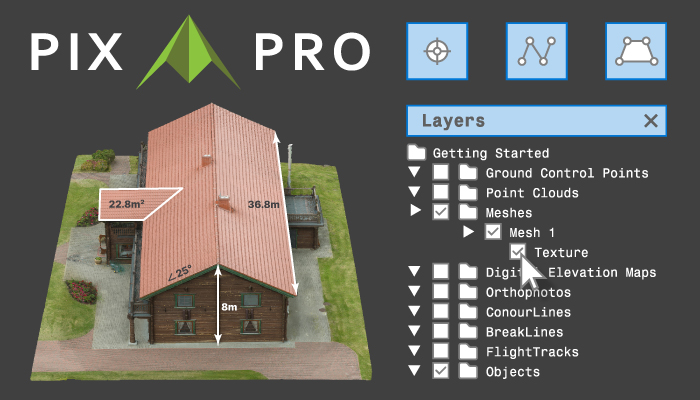
Photo Credits: Pixpro UAB
Mic Mac
Mic Mac is a free and open-source photogrammetry software for 3D reconstruction. This software was developed in 2003 at the Instituto Nacional de Información Geográfica y Forestal (IGN) and the Escuela Nacional de Ciencias Geográficas (ENSG). At first, it was created exclusively for IGN’s cartographic production and it was only possible to use IGN’s internal image file format. In 2010, when the XML interface was replaced by a simplified command line, it allowed greater accessibility and dissemination to other communities. In addition to that, this software is available for Windows, Mac OSX, or GPU processing for certain tasks. The best thing about this software is that it can be used by beginners, experienced users, and experts. Because of that, this software has been used in numerous French and European projects.
Open Drone Map
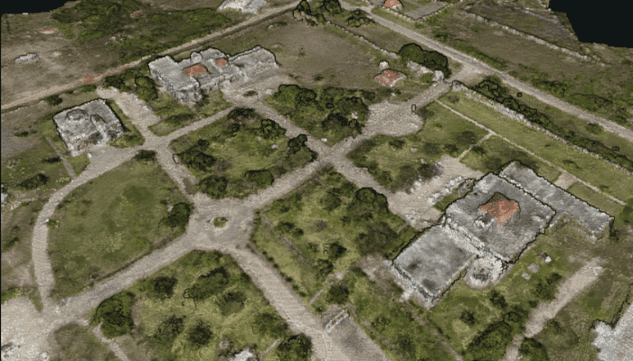
Open Drone Map is an open-source software to process images that have been captured by drones, converting them into geographic data in 3D for further use with other data. Some of its features are a point cloud, digital surface models, and digital surface models with texture, to name only a few. Open DroneMap has been built on Ubuntu 16.04 although it can be used on other platforms with Docker. Open DroneMap is built on Ubuntu 16.04 but can be run on other platforms using Docker. Some examples of products that can be created are 3D meshes, orthophotos, or point clouds.
PhotoModeler Technologies
This year, users of PhotoModeler photogrammetry software were able to enjoy a new version. With the new updates 2022.1 (released on February 16, 2022) and 2022.0, a total of over 100 improvements were made possible. These updates primarily focused on the main areas of marine work and also forensics and accident reconstruction. In addition to new shortcut keys, such as for exporting or drawing a curve, the program now also enables user-friendly surface drawing. That means that, for example, in line or curve mode, existing surface points can now be moved simply by dragging or clicking. This makes it much easier to edit, adjust, and correct points without having to leave the surface drawing mode. The software is available in standard and premium versions.
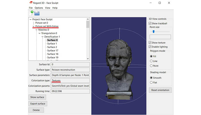
Regard3D
Regard3D is another free, open-source software solution, they call it a ‘structure-from-motion’ program, meaning that it can convert photos of an object taken from different angles into a 3D model of this object. You can run this solution on multiple platforms, Windows, OS X, and Linux, and count on powerful third-party tools and libraries. On their website, where you will find the software to download, you will also find a collection of tutorials to familiarise yourself with the program and regular updates.
WebODM
WebODM is a solution designed to be user-friendly and produce elevation models, textured models, geo-referenced maps and point clouds using aerial images from drones. This software is a project from OpenDroneMap, which is an open ecosystem of solutions for collecting, processing, analyzing, and displaying aerial data. Once you download this drone photogrammetry program, it runs on your computer even when offline. The installation and technical support cost $57, this is a one-time fee, and there are no monthly payments. You can find more information in the video below.
Pix4D
Pix4D is a photogrammetry software editor. It offers several solutions according to the needs of the user and allows to measure different data from a drone, a camera, or even a plane. The company currently offers 5 mapping and 3D modeling software among which we find PIX4Dmapper, an offer for professionals who are using drones or other cameras. Users are be able to integrate any RGB, thermal or multispectral image; after the digitization step, they are also able to measure surfaces, volumes, and distances. The company also offers other photogrammetry tools such as PIX4Dmatic designed to make land maps.
Trimble Inpho
Trimble Inpho is one of the leading software solutions for digital photogrammetry, offered by Trimble Geospatial. Again, this software is aimed at aerial images; it transforms them into accurate point clouds, surface models, orthophoto mosaics, and digitized 3D features. Trimble Inpho is a reliable solution as it is one of the oldest on the market, with 30 years of experience, Trimble Geospatial is capable of offering a robust solution.
What do you think of our listing of photogrammetry software? Let us know in a comment below or on our LinkedIn, Facebook, and Twitter pages! Don’t forget to sign up for our free weekly Newsletter here, the latest 3D printing news straight to your inbox! You can also find all our videos on our YouTube channel.


I want to photograph a 2D subject, a C19th print, as a mosaic. Then, stitch the mosaic together to make a high resolution 2D image. I am not interested (yet) in a 3D output.
MS ICE is not reliable, in joining the edges without distortion.
Could you recommend software that might do this?
That Harry Lodge guy sounds hot
Photogrammetry is the science and technology of obtaining reliable information about physical objects and the environment through the process of recording, measuring, and interpreting photographic images and patterns of electromagnetic radiant imagery and other phenomena. Photogrammetry works by using 3D geometry, but let’s talk about what that means. … With this information and a point identified on two or more photos, our software finds the geometric intersection of the light rays and figures out where that point is located in 3D space.
Hello,
do you have a tool to convert 2D to 3D.? an Api tools to be used on my website ?
Did you try eyescloud3D?